
- Today: SE Georgia – Heavy Rainfall & Severe Storms
- Thu: Heavy Rainfall SE GA & Severe T’storm Threat Afternoon & Evening SE GA & NE FL
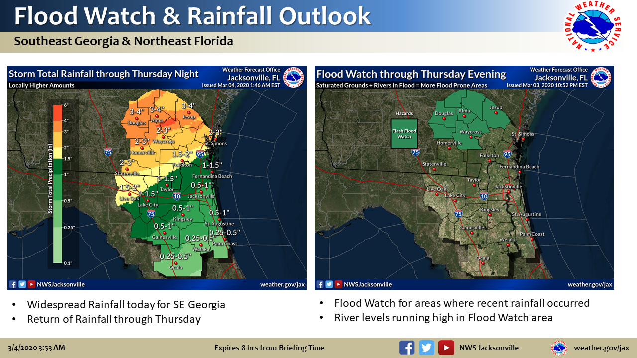
- Flood Watch in Effect for Parts of SE GA
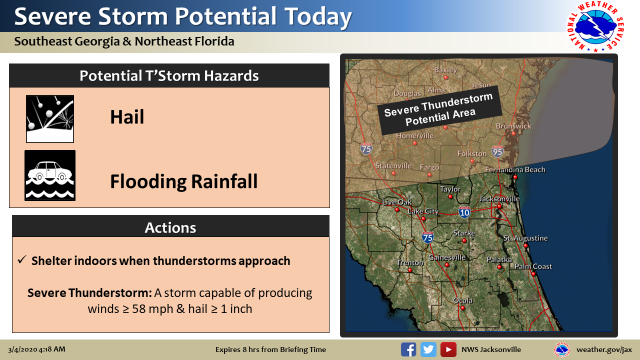
A dynamic weather pattern will be in place across the local area with a stalled front meandering over south Georgia today then low pressure crossing the local area tomorrow. This morning isolated strong to severe storms across SE GA could produce hail, in addition to heavy rainfall. Strong to severe storms are also possible this afternoon across SE GA which will be capable of damaging winds & isolated tornadoes. Storms are expected to taper off in intensity this evening after sunset through midnight as they approach NE Florida.
Thursday low pressure crosses the local area in the afternoon with heavy rainfall and isolated tornado potential across southeast Georgia near the surface low, while severe storms will be favored south of the surface low across NE FL ahead of the cold front which could produce damaging wind gusts & possibly isolated tornadoes. The timing for severe storms Thu is generally 2 pm – 10 pm.
Storms will move offshore Thursday evening with drier and cooler conditions through sunrise Friday morning with a dry and cooler weekend expected.
POSTED: 03-04-20 | 07:30 hrs