Synopsis & Timing
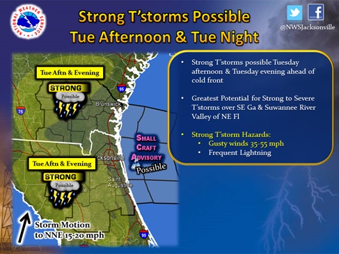
A cold front will approach the local forecast area from the west Tuesday afternoon. Pre-frontal showers and thunderstorms will impact the local forecast area Tuesday afternoon through early Wednesday, with gradual clearing Wednesday afternoon.
A couple waves of rainfall are possible associated with this front. The first wave of showers and thunderstorms is expected Tuesday afternoon mainly across inland areas, with a few strong storms possible. The next wave of showers and thunderstorms is expected to cross the area Tuesday night from west to east ahead of the actual cold front. A few strong storms will be possible with this broken band of rainfall, with the greatest potential for strong storms across inland southeast Georgia and the Suwanee River Valley of northeast Florida Tuesday evening.

10.13.14
15:30 hrs
