
Overview:
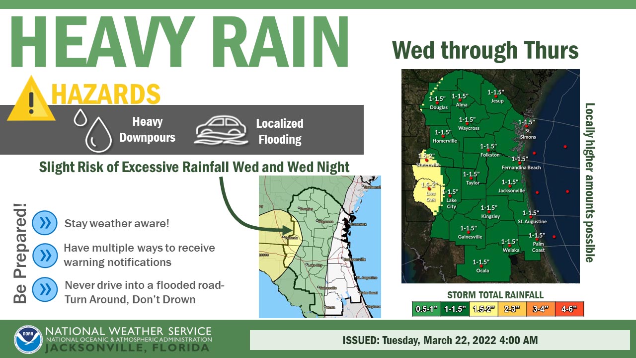
A severe weather outbreak will progress eastward from the lower Mississippi Valley this afternoon and across the FL panhandle and Deep South tonight. This storm system will approach our region on Wednesday, bringing a threat for strong to severe thunderstorms and widespread heavy downpours to our area on Wednesday afternoon and evening. Higher probabilities for damaging wind gusts, hail, and isolated tornadoes are expected for locations along and north of the Interstate 10 corridor on Wednesday afternoon and evening. This storm system’s frontal boundary is expected to stall across our area on Wednesday night, keeping the threat for heavy downpours and potentially strong storms in the forecast through Thursday evening.
A severe weather outbreak will progress eastward from the lower Mississippi Valley this afternoon and across the FL panhandle and Deep South tonight. This storm system will approach our region on Wednesday, bringing a threat for strong to severe thunderstorms and widespread heavy downpours to our area on Wednesday afternoon and evening. Higher probabilities for damaging wind gusts, hail, and isolated tornadoes are expected for locations along and north of the Interstate 10 corridor on Wednesday afternoon and evening. This storm system’s frontal boundary is expected to stall across our area on Wednesday night, keeping the threat for heavy downpours and potentially strong storms in the forecast through Thursday evening.
POSTED: 03-22-22 | 13:45 hrs