 As this is a fluid situation with many factors involved, check in for further updates
Synopsis & Timing
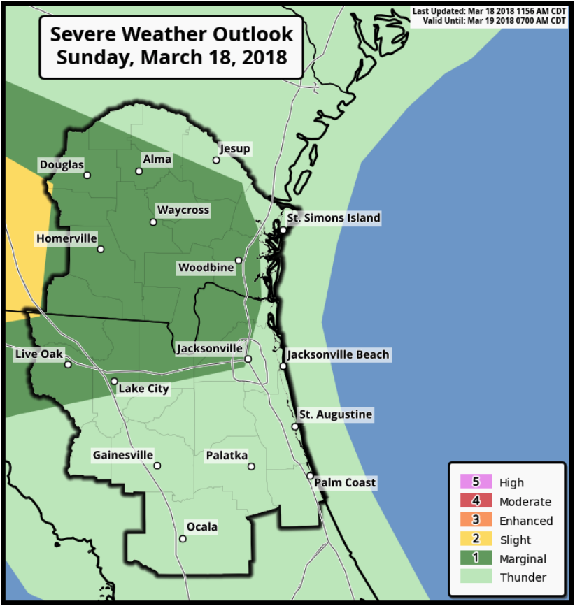
Severe weather potential from this evening through Tuesday evening
- Multiple rounds possible
- SPC Marginal risk tonight, Slight risk on Monday and Enhanced Risk for Tuesday
- Threat for damaging winds, hail and a few tornadoes especially Monday and Tuesday
- Timing and confidence will increase as the event unfolds
Strong to severe thunderstorms may develop west of the region this afternoon and move into the area this evening.
Timing: after 7pm
Location: North of I-10 in NE
Florida and most of SE Georgia
Damaging winds and hail the primary hazards

MONDAY
- Some strong to severe thunderstorms may be ongoing Monday morning.
- More likely round of severe weather possible during the afternoon and evening hours.
- Damaging winds, hail, and a few tornadoes are possible
TUESDAY
- Cold front moves through on Tuesday
- Severe thunderstorms possible late morning through late afternoon
- Damaging winds, hail, and a few tornadoes are possible
POSTED: 03-18-18 | 17:30 hrs
