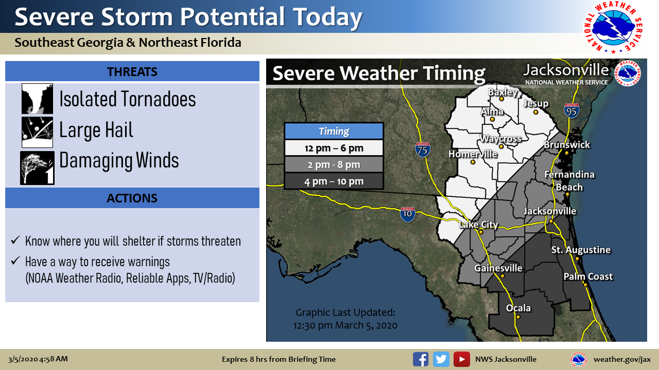
A dynamic weather day as an area of low pressure tracks east across the local area this afternoon. Flooding rainfall potential will return to SE Georgia and severe thunderstorm potential will develop across the entire forecast area this afternoon & early evening.
The greatest area of threat appears to be from a Waycross GA to Brunswick GA line southward to the I-10 corridor. Further north, a few severe storms with large hail will be possible.
Flood Potential for SE Georgia:
- 24-hr rain totals near Altamaha River basin 3-4 inches
- Additional 1-2 inches today – locally higher amounts
- Flood Watch continues through 7 pm
- Rivers in or Rising to Flood: Okmulgee, Altamaha, Satilla, Alapaha
Severe Thunderstorm Potential SE Georgia & NE Florida:
- SE GA: Tornado Threat this Afternoon (Hail & Damaging Winds Also Possible)
- NE FL: Broken Squall Line Afternoon & Early Evening (Damaging Winds)
- Will Impact Rush Hour Commute
Storms will push offshore this evening, with just light showers for NE FL after midnight.
Cooler & dry Friday into the weekend – inland frost potential Sat night.

POSTED: 03-05-20 | 11:00 hrs
