
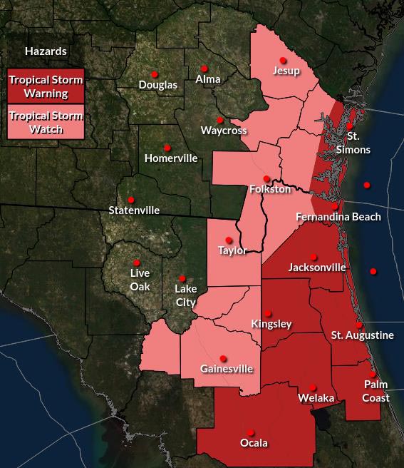
![]() Potential for Tropical Storm force winds as early as during the day Wednesday, but more likely late Thursday Night into early Friday for the Waycross area. Potential for wind gusts possible on Thursday. Rain throughout Friday and Saturday early morning.
Potential for Tropical Storm force winds as early as during the day Wednesday, but more likely late Thursday Night into early Friday for the Waycross area. Potential for wind gusts possible on Thursday. Rain throughout Friday and Saturday early morning.
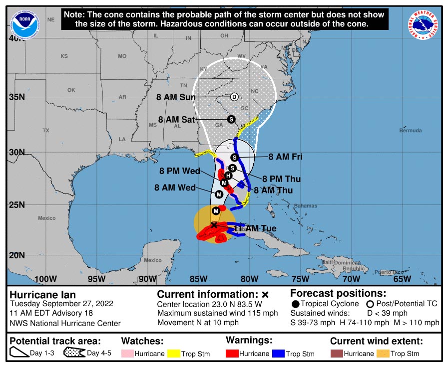
- Ian is now a Major Hurricane
- Tropical Storm Watches and Warnings in Effect for the Atlantic coast and portions of inland NE FL and SE GA. – Strong tropical force winds with gusts to hurricane force are possible
- Storm Surge Watches and Warnings are in effect along the NE FL and SE GA coast, ICWW, and St. Johns River Basin – Moderate storm surge expected
- Flood Watch in effect for much of Northeast FL – Flash Flooding possible
- Some Northeast FL Rivers could go to Moderate to Major Flooding later this week
- Dangerous Marine Conditions expected
- Several Tornadoes possible
POSTED: 09-27-22 | 17:00 hrs