
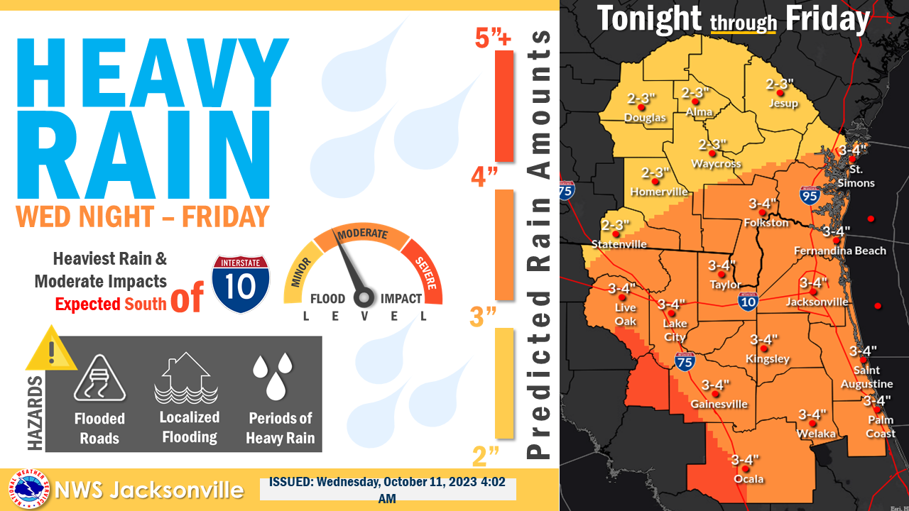
The combination of a warm front lifting into the region, an area of low pressure sliding eastward along it, and summer-like moisture will bring heavy rain to the area and the potential for isolated severe thunderstorms during the overnight hours tonight into Thursday morning. The setup will be favorable for isolated tornadoes in addition to strong thunderstorm winds. Rain amounts today through Friday will push toward 2-3” in the Waycross area, with locally higher amounts possible. However, given the recent dryness, a widespread flood threat remains low with only isolated flood occurrences expected.
POSTED: 10-11-23 | 10:15 hrs