High pressure is building over and south of our area with a consistent westerly flow. This is a hot scenario for our region for several reasons.
The westerly flow suppresses the Atlantic Ocean sea breeze thus reducing cooling and it travels over ground heated by the sun and becomes quite hot.
The high pressure causes sinking air which reduces cloud coverage and allows the sun to further heat up the ground.
Then both of the above situations also serve to reduce the amount of moisture in the air allowing the air to heat up even more.
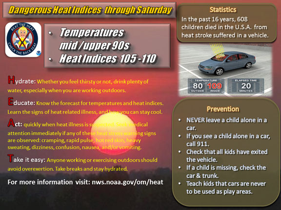
The bottom line is both Thursday and Friday will see highs in the 97-101 range and heat index values approaching 110 degrees (especially over interior southeast Georgia and the Suwannee Valley). Further overnight temperatures will only drop into the mid to upper 70s with high relative humidity. Those without air conditioning will find little relief overnight. So we could find ourselves in a situation where people are experiencing heat related injuries late this week and this weekend.

08-22-14
12:45 hrs
