
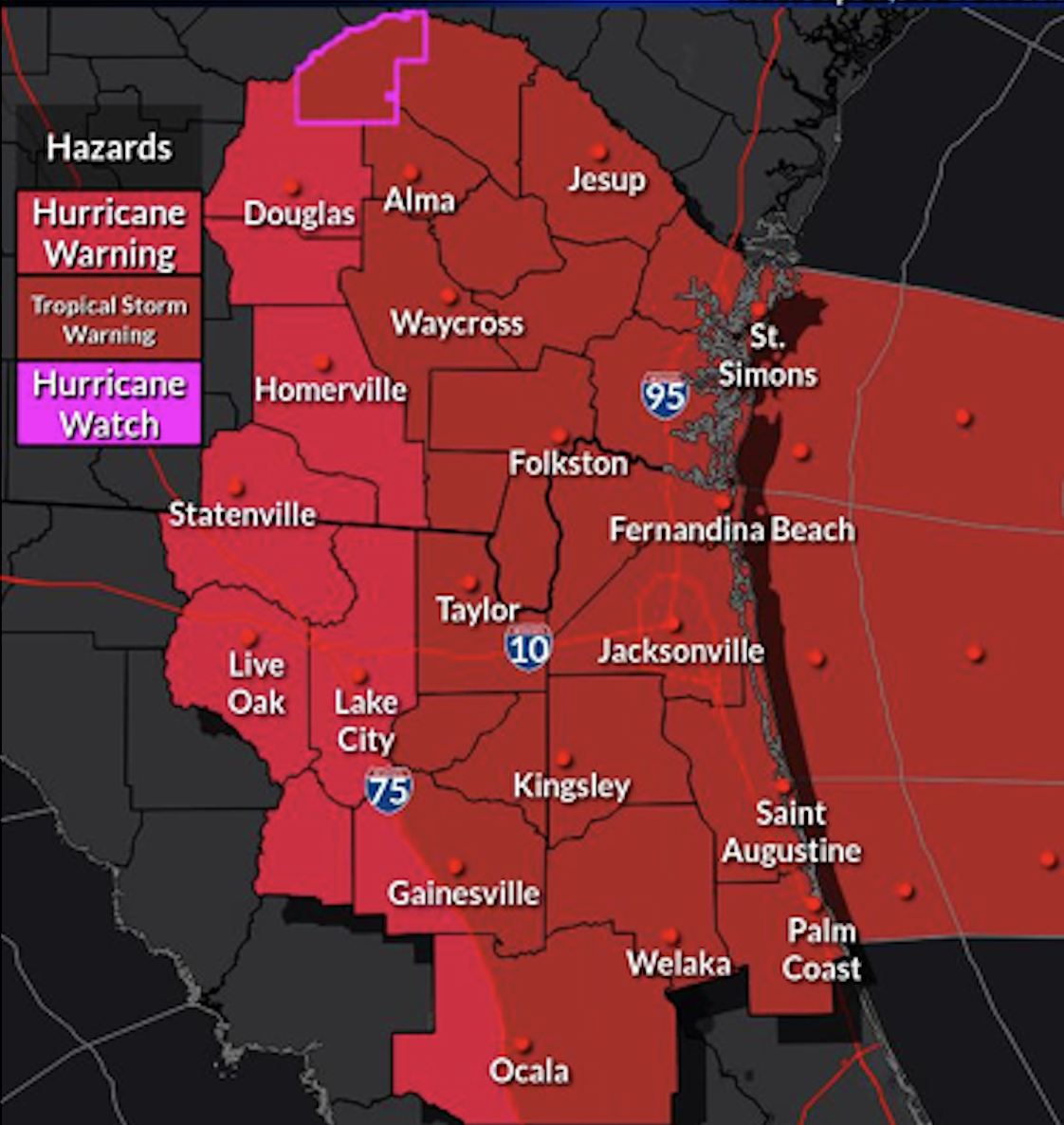
Hurricane Helene is starting its track into the southeast Gulf of Mexico is forecast to strengthen, becoming a major hurricane in 24 hours and retain that status prior to landfall in or near Apalachee Bay on Thursday evening. The potential for direct impacts is increasing across our area, with local impacts possible beginning this late afternoon/evening (initial rain bands) and lasting through early Friday morning. Hurricane and Tropical Storm Warnings are in place and there is a flood watch for our region for potential impacts from Helene.
Hurricane Helene is expected to undergo rapid intensification as it progresses northward further into the Gulf this afternoon through Thursday evening. The wind field is anticipated to appreciably expand, leading to significant impacts beyond the Helene’s eye and track forecast cone. Please keep in mind that it is essential to monitor the overall impact rather than focusing solely on the exact track or the track forecast cone.
Tropical storm-force winds are expected in most areas, with hurricane force winds possible along the I-75 corridor in the Suwannee Valley and far western portions of north central FL, as well as portions of inland southeast GA, particularly as Helene accelerates northward Thursday afternoon and night.
Heavy rainfall is forecast, especially for inland southeast GA and the Suwannee Valley. There is a potential for isolated tornadoes within Helene’s outer rainbands across our entire area from this evening through Thursday evening. The initial rain bands are expected to begin this late afternoon or evening across north central and northeast FL and will continue to progress northward overnight into Thursday morning in southeast GA.
Additionally, dangerous marine and surf conditions will develop along the coast. Deteriorating marine conditions will start this afternoon and with conditions further degrading tonight and further degenerating Thursday through Thursday night, gradually tapering off on Friday. During times of high tides some areas on St. Johns River and Coastal Georgia may have tidal flooding of low-lying areas that includes docks, boat ramps, parking lots and some roads Thursday and Thursday night.
Please stay safe and informed as Hurricane Helene continues to strengthen and then rapidly intensifies over the eastern Gulf of Mexico later today and Thursday.
POSTED: 09-25-24 | 14:15 hrs