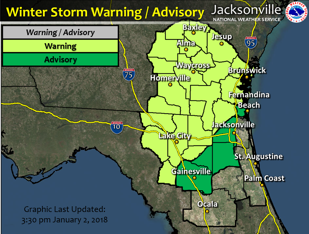
Winter Storm Warning
NWS WFO Jacksonville has produced briefings on the potential for frozen precipitation from late tonight through Wednesday afternoon, as well as the ongoing cold spell that will persist through Saturday.
Frozen precipitation expected over most of southeast Georgia, the northern Suwannee Valley, and from west of metro Jacksonville area southeastward to Gainesville late tonight through Wednesday afternoon
Main impacts where wintry precipitation does occur
- Down Power Lines, Widespread Electrical Outages, Snapped Trees or Branches, and Black Ice All Possible with Heavier
- Wintry Mix of Precipitation (Freezing Rain, Sleet or Snow).
- The cold ground temperature causes the precipitation to freeze upon impact, thus creating ice and slick conditions, especially on elevated overpasses and bridges.
- Black ice is feasible. Sleet and the refreezing of snow or rain water can also generate black ice, particularly Wednesday night after sundown.
- Stranded Motorists
- Disruption of Emergency Services
- Even small amounts of ice and snow can cause hazardous driving conditions.
Three nights of Hard Freezes Inland and Light Freezes at the northeast Florida coast later this week
Latest overview
01/02/18

POSTED: 01-02-18 | 17:30 hrs
