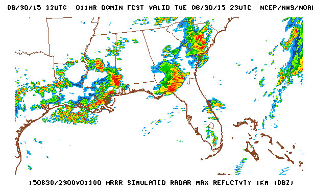
A cluster of strong to severe thunderstorms is building over the central portions of Alabama this morning. this cluster is expected to drop southeast over the NWS WFO Jacksonville AOR between 4 and 8 p.m. and then move over the coastal waters. The cluster should move over the area as a bow echo and the greatest risk of severe weather should be from gusty winds.

The highest likelihood of severe weather looks to be north of Florida State Road 20. The first image is the simulated max radar reflectivity around 5 p.m. and the second Simulated Reflectivity indicates the situation around 8 p.m.
Remember these times are only approximate and may slide a couple of hours either way. Remain alert for statements and possible Watches/Warnings later today. Spotters should self activate if a watch/warning is issued or severe weather enters the region.
NOAA Federal
06-30-15
11:15 hrs
