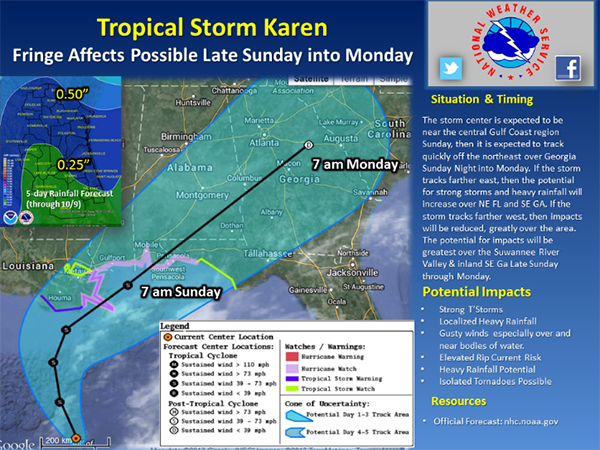
Tropical Storm Karen continues to track northward across the central Gulf of Mexico this mid afternoon. At this time, Karen continues to be quite debilitated and asymmetric with most of the weather to the east of the storm’s center as it is encountering westerly dry air and sheer on its western periphery. The environment does not look favorable for significant intensification with moderate shear for the next day also. There is significant confidence in the first 24 to 36 hours of the track. All of the guidance shows a sharp northeast turn in 36 to 48 hours, but with large differences in latitude at which the turn occurs and significant spread in where the center of the storm crosses the coast.

The majority of forecast and hurricane models and the ensuing official NHC forecast does track this system with landfall from southeast Louisiana to the Florida Panhandle. There are a few outlying models that show a more eastward track with landfall into the Florida Panhandle or Florida Big Bend where there could be potential local impacts across NE Florida and SE Georgia. We will continue to monitor these trends. If we do have this more eastward track, there is a potential of impacts across Northeast Florida and Southeast Georgia later Sunday and Monday. These local impacts may include a strong line of thunderstorms late Sunday night into Monday. Isolated tornadoes, gusty winds, and locally heavy rainfall may occur. Again, much hinges on the evolution and track of Tropical Storm Karen.
10-04-13
16:00 hrs
