Key Points:
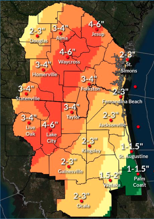
- Rounds of heavy rainfall will continue through mid-week, which could aggravate ongoing river flooding and enhance the potential for localized flash and urban/small stream flooding today through Wed night.
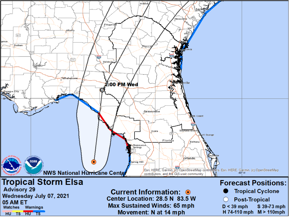
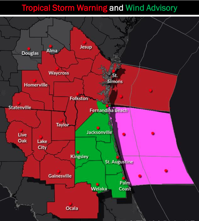
- There is a potential for tropical-storm-force winds, which could lead to fallen trees or tree limbs and power outages Tue-Wed.
- There is a low-end potential for minor storm surge Tue night-Wed night.
- Elsa’s track has shifted slightly westward.
- Monitor official forecast from the National Hurricane Center & your local NWS Office (be cautious of social media!)

POSTED: 07-07-21 | 9:45 hrs


