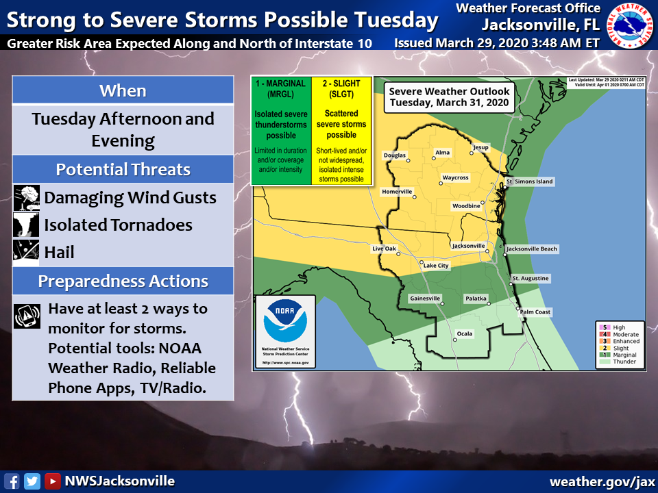
- Greatest Threat Area is Along and North of Interstate 10
- Damaging Wind Gusts, Isolated Tornadoes, and Hail Possible
- Windy Conditions Expected Tuesday Ahead of an Approaching Cold Front
Strengthening low pressure will move across the southeastern United States on Tuesday afternoon and evening, dragging a strong cold front eastward across our region by Tuesday night. Scattered strong to severe thunderstorms will be possible ahead of this cold front, mainly for locations along and north of the Interstate 10 corridor, during the afternoon and evening hours. Any severe thunderstorms that develop will be capable of producing damaging winds, isolated tornadoes, and hail. The Storm Prediction Center has placed locations along and north of I-10 within a “slight risk” for severe thunderstorms at this time, which means that scattered severe thunderstorms will be possible. In addition to the severe weather threat, windy conditions are expected to develop on Tuesday morning in advance of the approaching strong cold front, with frequent southwesterly wind gusts of 30-35 mph expected by early afternoon.
Storms will move offshore Tuesday night, with seasonably cooler and drier conditions expected beginning midweek.