
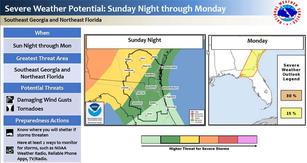
A pre-frontal squall line in association with a cold front approaching the area will potentially produce a squall line that will be encroaching toward interior SE GA and the Suwannee Valley region after midnight. The slow-moving squall line will continue to press east-southeast during the overnight and pre-dawn hours Monday. During the morning daylight hours, the line will start to make its approach toward the Georgia coastal counties and toward Highway 301. Pushing toward the First Coast by mid-morning and early afternoon. This timing confidence is low and still needs to be nailed down, with a disparity of model solutions with the time-frames of the severe weather for each part of the JAX AOR.
- Strong to Severe Thunderstorm Concerns:
- Nocturnal Event for SE GA and Suwannee River Valley
- Damaging Winds Gusts 50-70 mph
- Isolated Tornadoes
- Hail
POSTED: 04-10-20 | 13:15 hrs