
Synopsis & Timing
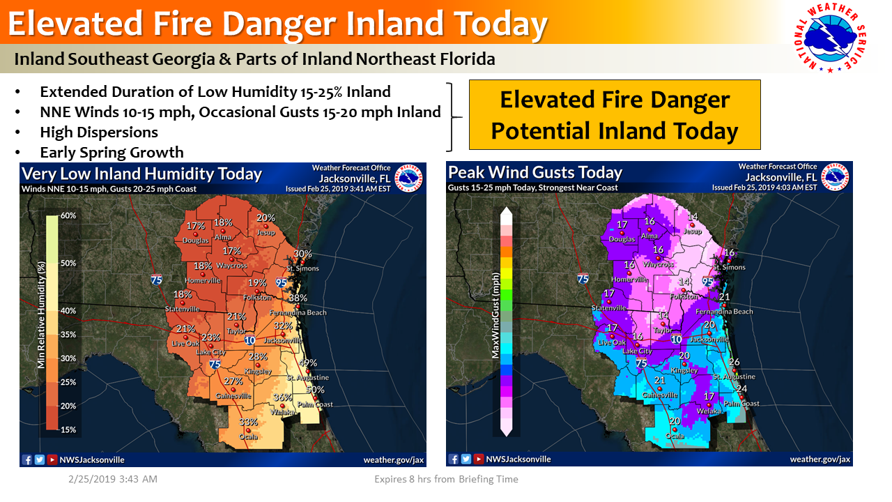
Although we just had wetting rainfall yesterday, the air mass has dried out very quickly overnight trailing a cold front passage.
Many locations are already in the 30-40% humidity range this morning, before sunrise.
Very dry air will remain in place today, with humidity expected to fall into the 15-25% range by midday.
We are not expecting Red Flag conditions as winds are not expected to reach criteria, however, breezy NNE wind gusts are expected at times in the 15-20 mph range where low humidity is expected.
Just wanted to give a head’s up for the potential for elevated fire danger today, given such a rapidly drying airmass and breezy NNE winds at times.
POSTED: 02-25-19 | 9:30 hrs