
Be Alert
Potential for rapid fire spread still looks highly probable tomorrow, Wednesday March 7th, pending no significant rainfall tonight.
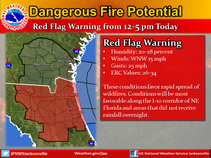
As you know, surface fuels are dry, and radar trends suggest little widespread rainfall potential tonight, except maybe across parts of NE FL south of the I-10 corridor where a few locally heavy showers or a thunderstorm could impact. The front will push south of SE GA by midnight and across NE FL by 7 am.
Wednesday Outlook:
- WNW 10-15 mph early morning, increasing to 15-20 mph by mid-morning with gusts up to 25 mph.
- Minimum RHs falling to 25-30%
- Dispersion is not very high due to cooler max temperatures
We know this is just a county over but we all know how these can easily start and spreed
Please be alert and vigilant, thank you
POSTED: 03-07-18 | 09:30 hrs