
- Potential for strong to severe thunderstorms during the predawn hours on Wednesday along and west of the Interstate 75 corridor.
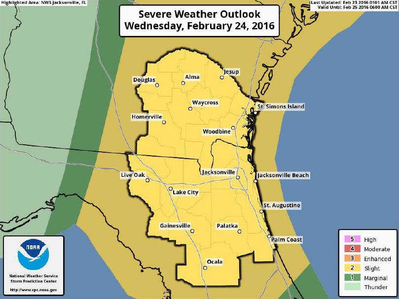
- Potential for strong to severe thunderstorms Wednesday morning through early afternoon across southeast GA and northeast FL.
- Primary threats are damaging wind gusts and hail, but conditions will also support isolated tornadoes.
There is a slight risk of severe thunderstorms late tonight through Wednesday morning across northeast FL and southeast GA.
A squall line of strong to severe thunderstorms will move quickly eastward across our area during the morning hours and will exit the Atlantic coast around noon, potentially producing damaging wind gusts, hail, and isolated tornadoes.
Some potential exists for a few strong/severe storms to develop ahead of the squall line during the predawn and early morning hours.
Marginally Severe Hail: Possible after 4 AM through sunrise Wednesday morning along and west of I-75 corridor.
Damaging Winds up to 60 mph: A key hazard with thunderstorms along a squall line ahead of a strong cold front, and any storms that develop ahead of the squall line.
Tornadoes: Atmospheric conditions are expected to become favorable for isolated tornadoes, particularly if thunderstorms develop ahead of the squall line overnight through Wednesday morning.
Lightning: Only occasional cloud to ground lightning strikes are expected due to the expected low-topped nature of the thunderstorms that develop.
Rainfall: Fast storm motion should reduce potential for heavy rainfall amounts. Rainfall totals through early Wednesday afternoon should average 0.5-1.0 inch.
Threat timing: Most likely 4 AM – 9 AM western areas and 9 AM – 1 PM for central and eastern locations.
- Closely monitor the latest weather forecast information from your National Weather Service office Jacksonville.
- Confidence for the potential of strong to severe thunderstorms along and ahead of a squall line is increasing for the predawn and morning hours on Wednesday.
- Potential will exist for strong to severe thunderstorms during the predawn hours on Wednesday along the I-75 corridor and throughout the morning hours across the central and eastern portions of northern FL and southeast GA, with activity moving offshore by the early afternoon hours.
- The primary threats will include damaging wind gusts and hail. Conditions will also be conducive for isolated tornadoes.
- The next briefing is expected to be issued on Tuesday afternoon.
02-23-16
12:00 hrs