
Severe Weather Outlook
 for the NWS WFO Jacksonville Area Of Responsibility.
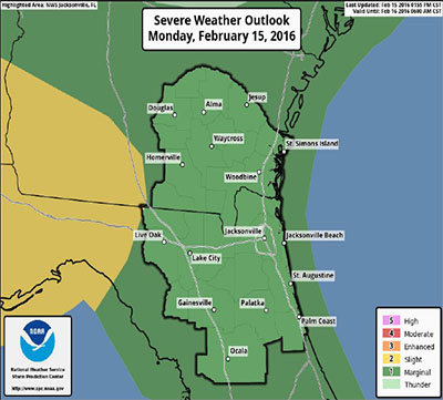
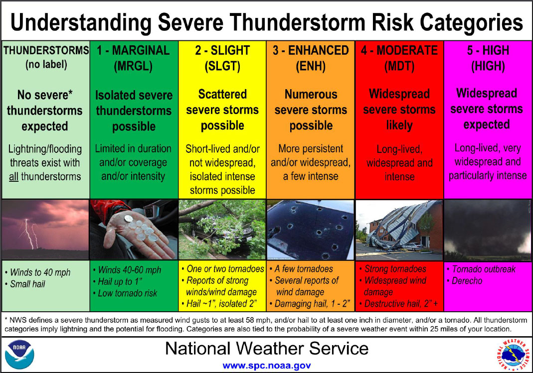
There is a MARGINAL risk of severe storms across all of Northeast Florida and Southeast Georgia as depicted in the SPC graphic to the right.
- Strong cold front will push through the region late tonight while moving rapidly eastward.
- Isolated strong to severe storms are expected. Gusty strong and/or damaging winds are the main threat. Large Hail is also possible. An isolated tornado cannot be ruled out.
- Timing: The potential squall line will impact inland Southeast Georgia and inland North Florida in the Midnight to 3 am time frame, then push into coastal Southeast Georgia and the remainder of Northeast Florida in the 3am to 6am time frame.
- There is a “low risk” of severe weather and moderate confidence that strong thunderstorms will move through the area.
- The leading edge of potential severe storm squall line is expected to push into inland Southeast Georgia and inland North Florida around midnight tonight.
- There is a “low risk” of severe storms and a moderate risk of strong storms across the entire NE FL/SE GA region as it moves rapidly eastward during the overnight hours and pushes into the Atlantic Waters by sunrise Tuesday Morning.
- Gusty Strong and/or Damaging Winds are the main threat. Large Hail and/or an isolated tornado cannot be ruled out.
- Monitor NWS Jacksonville and local media outlets for updates. Have a plan to be able to receive warnings during the overnight hours by using NOAA Weather Radio or other technology.
- This will be the only briefing issued on this event unless a Severe Weather Watch is issued for the area.
02-15-16
17:30 hrs